
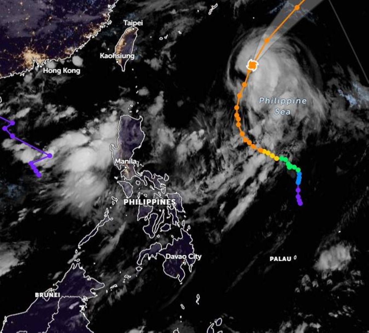
TYPHOON “Chedeng” has weakened while moving away from the Philippine landmass, the Philippine Atmospheric, Geophysical and Astronomical Services Administration (Pagasa) said Sunday.
It is expected to leave the country's area of responsibility either Sunday or Monday morning.
Weather specialist Grace Castañeda said that the typhoon continues to enhance the southwest monsoon which affects most of Luzon and Visayas.
“Chedeng will continue moving away from Philippine landmass as it is forecast to accelerate north-eastward and leave the Philippine Area of Responsibility Sunday night or early Monday morning,” Castañeda said.
Moving north-northeast at 20 kilometers per hour (kph), the tropical cyclone will likely be downgraded into a severe tropical storm within the day or early Monday morning.
It was estimated at 990 kms east of extreme Northern Luzon while packing maximum sustained winds of 130 kph near the center and gustiness of up to 160 kph.
In the next two days, the enhancement of the southwest monsoon may bring gusty conditions in coastal and upland/mountainous areas including Metro Manila, Batanes, Babuyan Islands, Ilocos Region, Cordillera Administrative Region, Nueva Vizcaya, Central Luzon, CALABARZON (Cavite, Laguna, Batangas, Rizal and Quezon), MIMAROPA (Mindoro, Marinduque, Romblon and Palawan), Bicol Region and Western Visayas.
The weather bureau said that similar weather conditions will also be experienced in Calamian Islands, Cuyo Islands and Kalayaan Islands especially on Monday.
*****
Credit belongs to : www.manilatimes.net