
TYPHOON “Goring” may re-intensify into “near super typhoon strength” when it passes very close or make landfall in the vicinity of Batanes this Wednesday, the Philippine Atmospheric Geophysical Astronomical Services Administration (Pagasa) said on Tuesday.
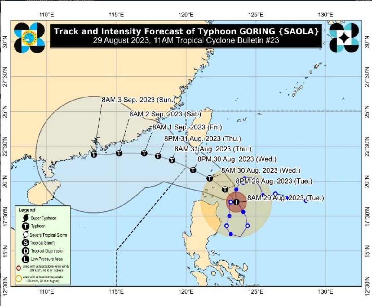
As of posting time, Signal No. 3 is up over the southern portion of Batanes (Sabtang, Uyugan, Ivana, Mahatao and Basco) and the northeastern portion of Babuyan Islands, Pagasa said in its 11 a.m. bulletin.
Signal No. 2 is up over the rest of Batanes and Babuyan Islands and the extreme northeastern portion of mainland Cagayan (Santa Ana and Gonzaga).
Signal No. 1 is up over the northern and eastern portions of mainland Cagayan (Camalaniugan, Pamplona, Santa Teresita, Baggao, Buguey, Claveria, Aparri, Ballesteros, Abulug, Sanchez-Mira, Santa Praxedes, Allacapan, Lal-Lo, Lasam, Peñablanca, Iguig, Amulung, Gattaran, Alcala and Santo Niño), the eastern portion of Isabela (Dinapigue, San Mariano, Ilagan City, Tumauini, San Pablo, Cabagan, Maconacon, Divilacan and Palanan), the northern portion of Apayao (Flora, Calanasan, Luna, Pudtol and Santa Marcela), and the northern portion of Ilocos Norte (Vintar, Pasuquin, Burgos, Dumalneg, Adams, Pagudpud and Bangui).
The center of the eye of Goring was estimated at 180 kilometers east of Aparri, Cagayan while moving northwestward slowly with maximum sustained winds of 155 kilometers per hour (kph) near the center and gustiness of up to 190kph, the state-run weather agency said.
The Goring-induced southwest monsoon or “habagat” will dump rains over the western portions of Central Luzon, Southern Luzon and Visayas over the next three days.
*****
Credit belongs to : www.manilatimes.net